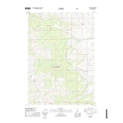
2020 Map of Lem Peak
USGS Topo · Published 2020About this map
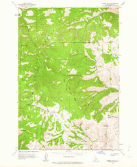
Lem Peak stands as the primary landmark within this high-elevation section of the Lemhi Range, dominating a landscape shaped by glacial basins and alpine drainage systems. As part of the Salmon National Forest, the terrain is defined by steep ridges like Long Ridge and deep catchments such as First Basin and Hayden Basin. The map reveals a complex network of headwaters, with Basin Creek and McNutt Cr carving through the northern slopes, while the southern reaches feed into Kadletz Creek and Hayden Creek. Water distribution is centered on several high-mountain clusters, including Basin Lake, Buck Lakes, and the Bear Valley Lakes. Access through this wilderness is traced by specialized routes such as Basin Creek Rd, Trail Creek Rd, and the Hayden Creek Loop, illustrating the infrastructure required for forest management and backcountry navigation.
Find a feature on this map
46 named features on this map. Tap any name to fly to it.
Don’t see what you’re looking for? This feature index may not catch every label — zoom into the map to look around manually.
Map Details
Editions of this 2020 Lem Peak Map
This is the sole edition of this map. No revisions or reprints were ever made.
Other maps of this area

1955 · Dubois
USGS Topo · 1:250,000

1956 · Patterson
USGS Topo · 1:62,500

1956 · May
USGS Topo · 1:62,500

1956 · Lemhi
USGS Topo · 1:62,500

1958 · Dubois
USGS Topo · 1:250,000
1962 · Allison Creek
USGS Topo · 1:24,000
1962 · Goldbug Ridge
USGS Topo · 1:24,000
1962 · Lem Peak
USGS Topo · 1:24,000
1962 · Poison Peak
USGS Topo · 1:24,000

1980 · Leadore
USGS Topo · 1:100,000