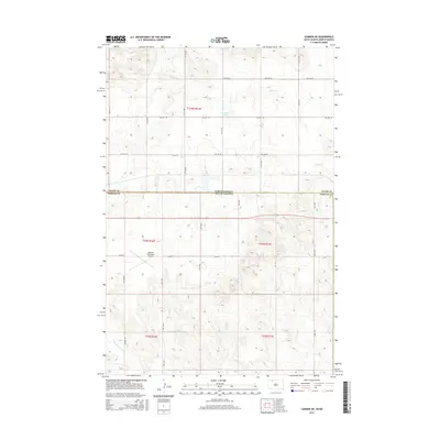
2015 Map of Lemmon NE
USGS Topo · Published 2015About this map
Adams Co and Perkins Co meet along the state line in this geographic study of the Dakota borderlands. The landscape is defined by the drainage of Plum Cr flowing through the northern sections and Thunder Hawk Cr to the south. Central to the southern portion of the map is the Lemmon Municipal Airport, a critical transportation hub for this rural stretch of the plains. A rigid grid of section roads, such as 102nd St and Airport Rd, segments the prairie, illustrating the enduring influence of the Public Land Survey System on local development. Small water bodies like Township Lake punctuate the terrain, providing essential landmarks in an area dominated by agricultural townships and open ranch land near the border of North and South Dakota.
Find a feature on this map
25 named features on this map. Tap any name to fly to it.
Don’t see what you’re looking for? This feature index may not catch every label — zoom into the map to look around manually.
Map Details
Editions of this 2015 Lemmon NE Map
This is the sole edition of this map. No revisions or reprints were ever made.
Other maps of this area

1953 · McIntosh
USGS Topo · 1:250,000

1953 · Dickinson
USGS Topo · 1:250,000

1954 · Lemmon
USGS Topo · 1:250,000

1954 · Bismarck
USGS Topo · 1:250,000

1957 · Dickinson
USGS Topo · 1:250,000

1957 · Lemmon
USGS Topo · 1:250,000

1958 · Bismarck
USGS Topo · 1:250,000

1958 · McIntosh
USGS Topo · 1:250,000

1972 · Round Top
USGS Topo · 1:24,000

1972 · Thunder Hawk SW
USGS Topo · 1:24,000