
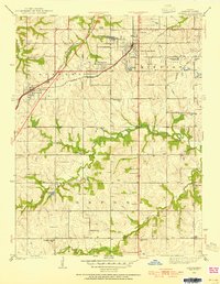
1935 Map of Lenexa
USGS Topo · Published 1935About this map
The St Louis and San Francisco RR serves as a primary transit corridor through the growing community of Lenexa, where the local landscape in the mid-1930s still balances agriculture with recreational and institutional development. The northeastern portion of the map reveals the early footprint of Overland Park, a suburb defined by its transition from rural township lands to organized residential blocks. Scattered throughout are essential social hubs for the community, including the Antioch Church and a high density of rural schoolhouses like Corinth Sch and Valley View Sch.
Find a feature on this map
29 named features on this map. Tap any name to fly to it.
Don’t see what you’re looking for? This feature index may not catch every label — zoom into the map to look around manually.
Map Details
Editions of this 1935 Lenexa Map
2 editions found
Other maps of this area

1887 · Olathe
USGS Topo · 1:125,000

1890 · Kansas City
USGS Topo · 1:125,000

1893 · Olathe
USGS Topo · 1:125,000

1894 · Kansas City
USGS Topo · 1:125,000

1934 · Bonner Springs
USGS Topo · 1:48,000

1934 · Grandview
USGS Topo · 1:24,000

1934 · Shawnee
USGS Topo · 1:24,000

1934 · Edwardsville
USGS Topo · 1:24,000

1935 · Olathe
USGS Topo · 1:24,000

1935 · Kansas City
USGS Topo · 1:24,000