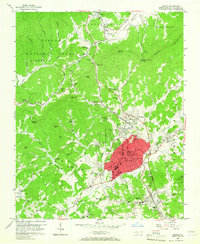
1956 Map of Lenoir
USGS Topo · Published 1965About this map
Lenoir serves as the central hub of this mid-century survey, its urban core detailed with the Courthouse, City Hall, and the Caldwell Memorial Hospital. The surrounding countryside in Caldwell County is a landscape of established community roots, marked by dozens of small country churches and schools like Shiloh Ch and Bushtown Sch. To the west, the boundaries of the Pisgah National Forest encompass peaks such as Grassy Knob and Peaked Top, while the Southern Railway tracks trace a path through the southern industrial outskirts near Whitnel. The geography is defined by the transition from the high ridges of Warrior Mtn down to the fertile basins of the Yadkin River and Happy Valley River in the north. This map captures the area just as the Blue Ridge Parkway was becoming a primary artery for the region, contrasting the traditional foothill settlements like Patterson with the growing post-war expansion of the city center.
Find a feature on this map
75 named features on this map. Tap any name to fly to it.
Don’t see what you’re looking for? This feature index may not catch every label — zoom into the map to look around manually.
Map Details
Editions of this 1956 Lenoir Map
2 editions found

Other maps of this area

1889 · Wilkesboro
USGS Topo · 1:125,000

1891 · Wilkesboro
USGS Topo · 1:125,000

1893 · Cranberry
USGS Topo · 1:125,000

1895 · Hickory
USGS Topo · 1:125,000

1895 · Cranberry
USGS Topo · 1:125,000

1899 · Cranberry
USGS Topo · 1:125,000

1902 · Cranberry
USGS Topo · 1:125,000

1905 · Morganton
USGS Topo · 1:125,000

1936 · Blowing Rock
USGS Topo · 1:48,000

1942 · Blowing Rock
USGS Topo · 1:62,500