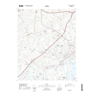
2019 Map of Lenoir City
USGS Topo · Published 2019About this map
Lenoir City anchors this 2019 survey, situated where the confluence of the Tennessee River and Tellico Lake shapes the local geography. The landscape is defined by the expansive waters of Watts Bar Lake and Melton Hill Lake, with numerous islands and bends such as Bussell Island and Blair Bend marking the river's course. Local history is preserved in several family and community burial grounds, including the Potters Field Cem, Crandall Cem, and the Loudon County Memorial Gardens. Small airfields like the Big T Airport and Cox Farm Airport are scattered across the terrain, reflecting the modern rural-suburban mix of Loudon Co and Roane Co. Settlement patterns extend from the established city center out toward Eaton Crossroads and the planned community of Tellico Village, illustrating the continued growth and residential development along the river's banks in this part of eastern Tennessee.
Find a feature on this map
229 named features on this map. Tap any name to fly to it.
Don’t see what you’re looking for? This feature index may not catch every label — zoom into the map to look around manually.
Map Details
Editions of this 2019 Lenoir City Map
This is the sole edition of this map. No revisions or reprints were ever made.
Other maps of this area

1895 · Loudon
USGS Topo · 1:125,000

1935 · Meadow
USGS Topo · 1:24,000

1935 · Lenoir City
USGS Topo · 1:24,000

1935 · Elverton
USGS Topo · 1:24,000

1935 · Bethel Valley
USGS Topo · 1:24,000

1935 · Philadelphia
USGS Topo · 1:24,000

1935 · Lovell
USGS Topo · 1:24,000

1936 · Cave Creek
USGS Topo · 1:24,000

1936 · Friendship
USGS Topo · 1:48,000

1936 · Loudon
USGS Topo · 1:24,000