Loading...
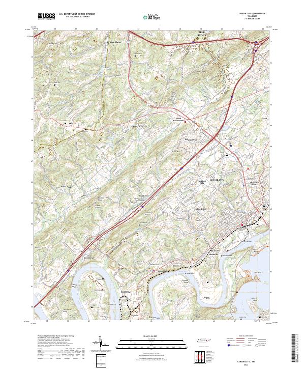
Loading map...2022 Map of Lenoir City
USGS Topo · Published 2022About this map
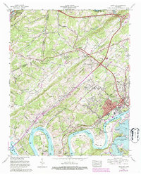
The Tennessee River and Little Tennessee River converge here, shaping the landscape of eastern Tennessee near Lenoir City and Loudon. The topography is defined by parallel ridges such as Blackoak Ridge and Chestnut Ridge that flank the Hotchkiss Valley. This map documents a modern landscape where historical river crossings and bends, like Huff Ferry Bend and Harrison Bend, coexist with contemporary infrastructure including Interstate 40 and Interstate 75.
Find a feature on this map
78 named features on this map. Tap any name to fly to it.
Don’t see what you’re looking for? This feature index may not catch every label — zoom into the map to look around manually.
Map Details
Date Portrayed2022
Date Published2022
PublisherU.S. Geological Survey
Map TypeTopographic
Scale1:24000
Physical Dimensions24 x 29 inches
Editions of this 2022 Lenoir City Map
This is the sole edition of this map. No revisions or reprints were ever made.
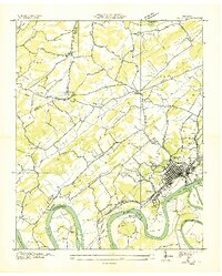
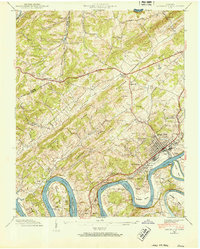
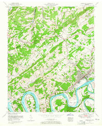
Historical Maps of Oak Grove Through Time
5 maps found
Featured Locations
Source Details
SourceU.S. Geological Survey
CopyrightPublic Domain