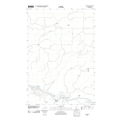
2010 Map of Lenore
USGS Topo · Published 2010About this map
The Clearwater River winds through the southern portion of this landscape, serving as a primary corridor for transportation and settlement near the communities of Lenore and Agatha. The topography is defined by significant elevations and depressions, notably Potlatch Ridge in the north and the deep cuts of Rattlesnake Canyon and Wheeler Canyon to the south. Small upland settlements like Cameron and Leland are connected by a network of rural roads, including County Hwy-P1 and Southwick Rd, which follow the natural contours of the land.
Find a feature on this map
45 named features on this map. Tap any name to fly to it.
Don’t see what you’re looking for? This feature index may not catch every label — zoom into the map to look around manually.
Map Details
Editions of this 2010 Lenore Map
This is the sole edition of this map. No revisions or reprints were ever made.
Other maps of this area

1924 · Kamiah
USGS Topo · 1:125,000

1955 · Pullman
USGS Topo · 1:250,000

1958 · Pullman
USGS Topo · 1:250,000

1958 · Culdesac
USGS Topo · 1:62,500

1961 · Kendrick
USGS Topo · 1:62,500

1961 · Ahsahka
USGS Topo · 1:62,500

1967 · Peck
USGS Topo · 1:24,000

1981 · Orofino
USGS Topo · 1:100,000

1981 · Potlatch
USGS Topo · 1:100,000
1984 · Culdesac North
USGS Topo · 1:24,000