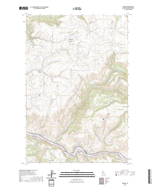
2024 Map of Lenore
USGS Topo · Published 2024About this map
The Clearwater River carves a deep valley through the Nez Perce landscape, creating a dramatic contrast between the riverine settlements and the high agricultural plateaus. This modern topographic study shows the communities of Lenore and Agatha situated along the riverbank, while the upland farming hamlets of Cameron and Leland occupy the flatter terrain of Potlatch Ridge. The local geography is defined by steep descents such as Bennett Grade and Cooks Grade, which connect the river valley to the ridges above. Genealogists can identify significant burial sites including Cameron Cem and Lenora Cem. The map illustrates a landscape where roads follow the winding contours of ridges and gulches, reflecting the historical movement between the fertile river flats and the wheat-growing benches like Amos Bench.
Find a feature on this map
65 named features on this map. Tap any name to fly to it.
Don’t see what you’re looking for? This feature index may not catch every label — zoom into the map to look around manually.
Map Details
Editions of this 2024 Lenore Map
This is the sole edition of this map. No revisions or reprints were ever made.
Other maps of this area

1924 · Kamiah
USGS Topo · 1:125,000

1955 · Pullman
USGS Topo · 1:250,000

1958 · Pullman
USGS Topo · 1:250,000

1958 · Culdesac
USGS Topo · 1:62,500

1961 · Kendrick
USGS Topo · 1:62,500

1961 · Ahsahka
USGS Topo · 1:62,500

1967 · Peck
USGS Topo · 1:24,000

1981 · Orofino
USGS Topo · 1:100,000

1981 · Potlatch
USGS Topo · 1:100,000
1984 · Culdesac North
USGS Topo · 1:24,000