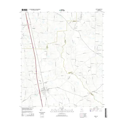
2014 Map of Lenox
USGS Topo · Published 2014About this map
Lenox serves as the central hub of this South Georgia landscape, where the town grid meets the interstate and local bypass routes. North of the town, the community of Staunton and the rural area of Eldorado anchor a region defined by an extensive network of family-named roads and drainage systems. The New River carves a winding path along the boundary between Cook and Berrien Counties, crossed by historic points such as Hesters Bridge and Brown Bridge. For genealogists, the map identifies several critical local landmarks, including Bethlehem Church and Ebenezer Church, along with the Mathis, Oaky Grove, and Rutland cemeteries. The terrain is notably water-rich, featuring Brushy Creek, Reedy Creek, and substantial water bodies like Betts Lake and Griffin Lake, which have long influenced the placement of farms and settlements throughout these coastal plain lowlands.
Find a feature on this map
118 named features on this map. Tap any name to fly to it.
Don’t see what you’re looking for? This feature index may not catch every label — zoom into the map to look around manually.
Map Details
Editions of this 2014 Lenox Map
This is the sole edition of this map. No revisions or reprints were ever made.
Other maps of this area

1953 · Waycross
USGS Topo · 1:250,000

1958 · Waycross
USGS Topo · 1:250,000

1973 · Adel
USGS Topo · 1:24,000

1973 · Sapps Lake
USGS Topo · 1:24,000

1973 · Nashville West
USGS Topo · 1:24,000

1973 · Enigma
USGS Topo · 1:24,000

1973 · Lenox
USGS Topo · 1:24,000

1973 · Tifton East
USGS Topo · 1:24,000

1973 · Tifton West
USGS Topo · 1:24,000

1973 · Omega
USGS Topo · 1:24,000