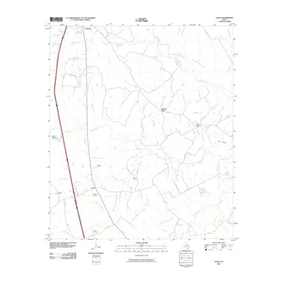
2010 Map of Leona
USGS Topo · Published 2010About this map
Leona and the southern edge of Centerville anchor this topographic survey of Leon County, where the Post Oak Savannah terrain is marked by a network of creeks and small family-named cemeteries. The landscape is defined by the drainage systems of Boggy Creek, Lower Keechi Creek, and Mustang Creek, which weave between low elevations such as Hayden Mountain. This area preserves a high concentration of local history through its burial grounds, including the Culton Cemetery, Makamsom Cemetery, and Durst Cemetery, suggesting a long-standing pattern of rural settlement. In the northeast, Pleasant Ridge serves as a local landmark, anchored by the Pleasant Ridge Church. The map provides a detailed view of the regional road network during the early 21st century, showing the transition from state roads like FM 1119 and FM 977 to numerous numbered county roads that provide access to the area's agricultural and ranching properties.
Find a feature on this map
50 named features on this map. Tap any name to fly to it.
Don’t see what you’re looking for? This feature index may not catch every label — zoom into the map to look around manually.
Map Details
Editions of this 2010 Leona Map
This is the sole edition of this map. No revisions or reprints were ever made.
Other maps of this area

1953 · Palestine
USGS Topo · 1:250,000

1954 · Waco
USGS Topo · 1:250,000

1955 · Waco
USGS Topo · 1:250,000

1956 · Jewett
USGS Topo · 1:62,500

1957 · Palestine
USGS Topo · 1:250,000

1964 · Centerville
USGS Topo · 1:24,000

1964 · Spring Seat
USGS Topo · 1:24,000

1964 · Eunice
USGS Topo · 1:24,000

1964 · Middleton
USGS Topo · 1:24,000

1964 · Leona
USGS Topo · 1:24,000