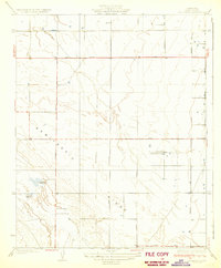
1930 Map of Leonards
USGS Topo · Published 1930About this map
Semitropic Ridge dominates the central topography of this Kern County landscape, surveyed in the late 1920s when agricultural expansion began to reshape the valley floor. The map highlights a transition from open terrain to structured ranching, evidenced by family-named landmarks like Rowlee Ranch and Goose Lake Ranch. The presence of specialized recreational sites, such as the Falcon Fliers Club, Porterville Gun Club, and Sicapte Gun Club, suggests a specific social use of the land during this era, likely tied to the seasonal wetlands and the nearby Jerry Slough.
Find a feature on this map
20 named features on this map. Tap any name to fly to it.
Don’t see what you’re looking for? This feature index may not catch every label — zoom into the map to look around manually.
Map Details
Editions of this 1930 Leonards Map
3 editions found
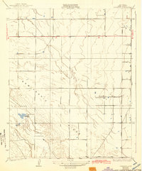
Other maps of this area

1910 · Buena Vista Lake
USGS Topo · 1:125,000

1912 · McKittrick
USGS Topo · 1:125,000

1912 · Buena Vista Lake
USGS Topo · 1:125,000

1914 · Lost Hills
USGS Topo · 1:125,000

1927 · Semitropic
USGS Topo · 1:31,680

1930 · Leonards
USGS Topo · 1:31,680

1930 · Hamlin School
USGS Topo · 1:31,680

1930 · Wasco
USGS Topo · 1:31,680

1930 · Pond
USGS Topo · 1:31,680

1930 · Miramonte Ranch
USGS Topo · 1:31,680