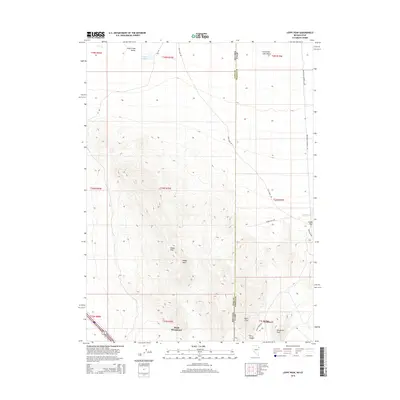
2015 Map of Leppy Peak
USGS Topo · Published 2015About this map
West Wendover, Nevada, and the adjacent settlement of Wendover, Utah, anchor the southern edge of this high-desert landscape where the Great Basin meets the salt flats. The border between Elko Co and Tooele Co cuts vertically through the quadrangle, dividing the high ground of the Leppy Hills from the vast expanse of the Great Salt Lake Desert to the east. Topographic details reveal a complex network of canyons and peaks, including the prominent Leppy Peak and Wendover Peak.
Find a feature on this map
28 named features on this map. Tap any name to fly to it.
Don’t see what you’re looking for? This feature index may not catch every label — zoom into the map to look around manually.
Map Details
Editions of this 2015 Leppy Peak Map
This is the sole edition of this map. No revisions or reprints were ever made.
Other maps of this area

1953 · Tooele
USGS Topo · 1:250,000

1955 · Tooele
USGS Topo · 1:250,000

1955 · Elko
USGS Topo · 1:250,000

1958 · Elko
USGS Topo · 1:250,000

1962 · Elko
USGS Topo · 1:250,000

1965 · Elko
USGS Topo · 1:250,000

1971 · Silver Island Pass
USGS Topo · 1:24,000
1971 · Miners Canyon
USGS Topo · 1:24,000

1971 · Pilot
USGS Topo · 1:24,000

1971 · Leppy Peak
USGS Topo · 1:24,000