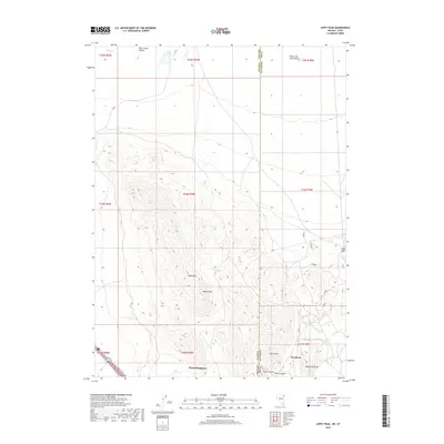
2018 Map of Leppy Peak
USGS Topo · Published 2018About this map
West Wendover and Wendover anchor the southern edge of this survey, marking the distinct transition from the high basin terrain into the vast expanse of the Great Salt Lake Desert. The landscape is dominated by the Leppy Hills, a complex geological formation rising to the prominent summit of Leppy Peak. This high ground serves as a natural barrier between the modern settlements and the historical path of the CA Trl, which winds through the Pilot Creek Valley in the northwest. Local topography is further defined by landmarks such as Bears Claw and Wendover Peak, while smaller features like Leppy Reservoir and the drainage of Pilot Cr provide scarce water sources in this arid environment. The map captures the significant state boundary where Nevada meets Utah, a line that divides the twin communities and dictates the unique development of this high-desert gateway.
Find a feature on this map
25 named features on this map. Tap any name to fly to it.
Don’t see what you’re looking for? This feature index may not catch every label — zoom into the map to look around manually.
Map Details
Editions of this 2018 Leppy Peak Map
This is the sole edition of this map. No revisions or reprints were ever made.
Other maps of this area

1953 · Tooele
USGS Topo · 1:250,000

1955 · Tooele
USGS Topo · 1:250,000

1955 · Elko
USGS Topo · 1:250,000

1958 · Elko
USGS Topo · 1:250,000

1962 · Elko
USGS Topo · 1:250,000

1965 · Elko
USGS Topo · 1:250,000

1971 · Silver Island Pass
USGS Topo · 1:24,000
1971 · Miners Canyon
USGS Topo · 1:24,000

1971 · Pilot
USGS Topo · 1:24,000

1971 · Leppy Peak
USGS Topo · 1:24,000