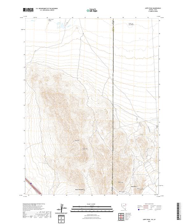
2021 Map of Leppy Peak
USGS Topo · Published 2021About this map
West Wendover and Wendover sit at the southern edge of this survey, straddling the high-desert borderlands where the Great Basin meets the Great Salt Lake Desert. The landscape is dominated by the prominent rise of Leppy Peak and the surrounding Leppy Hills, which separate the flat, arid plains to the north from the urban developments along Wendover Blvd. This modern topographic study shows the complex intersection of state and county lines, including the Nevada Utah border and the boundary between Elko and Tooele counties.
Find a feature on this map
29 named features on this map. Tap any name to fly to it.
Don’t see what you’re looking for? This feature index may not catch every label — zoom into the map to look around manually.
Map Details
Editions of this 2021 Leppy Peak Map
This is the sole edition of this map. No revisions or reprints were ever made.
Other maps of this area

1953 · Tooele
USGS Topo · 1:250,000

1955 · Tooele
USGS Topo · 1:250,000

1955 · Elko
USGS Topo · 1:250,000

1958 · Elko
USGS Topo · 1:250,000

1962 · Elko
USGS Topo · 1:250,000

1965 · Elko
USGS Topo · 1:250,000

1971 · Silver Island Pass
USGS Topo · 1:24,000
1971 · Miners Canyon
USGS Topo · 1:24,000

1971 · Pilot
USGS Topo · 1:24,000

1971 · Leppy Peak
USGS Topo · 1:24,000