
1954 Map of Leroy
USGS Topo · Published 1956About this map
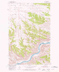
Leroy serves as the northern anchor for this mid-century survey of the rugged breaks where the High Plains drop toward the Missouri River. The landscape is defined by a series of prominent high points including Barnard Ridge, Red Rock Ridge, and Coal Ridge, which divide the terrain into deep coulees and wide alluvial flats like Greasewood Bottom. The map documents a sparsely populated ranching and dry-land farming region, centered on the Lone Tree Bench and its local Lone Tree Bench Sch. Along the river corridor, the survey captures the natural state of the waterway at Lone Pine Rapids and Castle Bluff Rapids. Industrial traces are few, though an Inactive Coal Mine near the southern border and several small water catchments like Dam 3430 reflect the constant struggle for resources in this semi-arid environment.
Find a feature on this map
26 named features on this map. Tap any name to fly to it.
Don’t see what you’re looking for? This feature index may not catch every label — zoom into the map to look around manually.
Map Details
Editions of this 1954 Leroy Map
2 editions found
Other maps of this area

1954 · Taffy Ridge
USGS Topo · 1:24,000

1954 · Bird Rapids
USGS Topo · 1:24,000

1954 · Gallatin Rapids
USGS Topo · 1:24,000

1954 · Lewistown
USGS Topo · 1:250,000

1959 · Lewistown
USGS Topo · 1:250,000

1964 · Ragland Bench
USGS Topo · 1:24,000
1985 · Nolan Reservoir
USGS Topo · 1:24,000

1985 · Woodhawk Hill
USGS Topo · 1:24,000
1985 · Sandpiper Reservoir
USGS Topo · 1:24,000
1985 · Saddle Rock
USGS Topo · 1:24,000