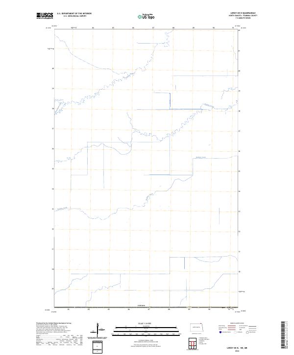
2024 Map of Leroy OE N
USGS Topo · Published 2024About this map
The international border between the United States and Canada defines the southern edge of this landscape in North Dakota. This section of Pembina County is characterized by a network of agricultural water management features that shape the rural terrain. The northern flow of Rosenheim Drain and Buffalo Drain dominates the drainage patterns, while the meandering course of Buffalo Creek winds across the center of the sheet. The map illustrates a highly organized landscape of section lines and water management, reflecting the region's agricultural foundations. Given the proximity to the international boundary and the specific drain systems present, this document is a primary resource for understanding contemporary land use and hydraulic engineering along the borderlands.
Find a feature on this map
5 named features on this map. Tap any name to fly to it.
Don’t see what you’re looking for? This feature index may not catch every label — zoom into the map to look around manually.
Map Details
Editions of this 2024 Leroy OE N Map
This is the sole edition of this map. No revisions or reprints were ever made.
Other maps of this area

1918 · Walhalla
USGS Topo · 1:62,500

1939 · Cavalier
USGS Topo · 1:62,500

1941 · Cavalier
USGS Topo · 1:62,500

1943 · Walhalla
USGS Topo · 1:62,500

1952 · Thief River Falls
USGS Topo · 1:250,000

1956 · Thief River Falls
USGS Topo · 1:250,000

1957 · Thief River Falls
USGS Topo · 1:250,000

1964 · Leroy
USGS Topo · 1:24,000

1964 · Walhalla
USGS Topo · 1:24,000
1964 · Cavalier NW
USGS Topo · 1:24,000