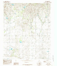
1985 Map of Lesley
USGS Topo · Published 1985About this map
Lesley serves as the central hub of this Panhandle landscape, where the agricultural plains meet a network of dissected drainages. The area is defined by the sharp transition between flat upland fields and the winding paths of Bitter Creek and its tributaries, such as East Bitter Creek. This 1980s topographic perspective shows a rural infrastructure heavily reliant on groundwater, evidenced by numerous wells scattered across the township lines.
Find a feature on this map
14 named features on this map. Tap any name to fly to it.
Don’t see what you’re looking for? This feature index may not catch every label — zoom into the map to look around manually.
Map Details
Editions of this 1985 Lesley Map
This is the sole edition of this map. No revisions or reprints were ever made.
Other maps of this area

1954 · Plainview
USGS Topo · 1:250,000

1958 · Plainview
USGS Topo · 1:250,000

1960 · Brice
USGS Topo · 1:62,500

1961 · Memphis
USGS Topo · 1:62,500

1963 · Hedley
USGS Topo · 1:24,000

1963 · Clarendon SE
USGS Topo · 1:24,000

1963 · Clarendon SW
USGS Topo · 1:24,000

1976 · Brice SE
USGS Topo · 1:24,000

1976 · Brice NW
USGS Topo · 1:24,000

1976 · Memphis NW
USGS Topo · 1:24,000