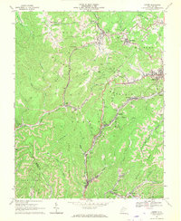
1967 Map of Lester
USGS Topo · Published 1970About this map
Slab Fork District and Trap Hill Town define the industrial heart of this Raleigh County landscape during the late 1960s. The map captures an era of intense resource extraction, where heavy rail infrastructure from the Norfolk and Western and Chesapeake and Ohio railroads weaves through the hollows to serve numerous mining operations. Prominent Mine Dumps and Strip Mines are mapped alongside the company towns that supported them, including Stotesbury, Tams, and Helen.
Find a feature on this map
66 named features on this map. Tap any name to fly to it.
Don’t see what you’re looking for? This feature index may not catch every label — zoom into the map to look around manually.
Map Details
Editions of this 1967 Lester Map
2 editions found
Other maps of this area

1891 · Raleigh
USGS Topo · 1:125,000

1897 · Raleigh
USGS Topo · 1:125,000

1902 · Raleigh
USGS Topo · 1:125,000

1911 · Marshes
USGS Topo · 1:48,000

1911 · Flattop
USGS Topo · 1:48,000

1911 · Beckley
USGS Topo · 1:48,000

1912 · Mullens
USGS Topo · 1:62,500

1913 · Beckley
USGS Topo · 1:62,500

1914 · Eccles
USGS Topo · 1:62,500

1914 · Flattop
USGS Topo · 1:62,500