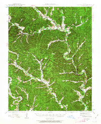
1943 Map of Lesterville
USGS Topo · Published 1963About this map
Centerville and Lesterville serve as the primary hubs in this mid-century survey of the Ozark highlands, where the Black River is formed by the confluence of the Middle Fork and West Fork. The landscape is defined by a dense network of creek valleys and ridges, including Vickery Mtn, which dictated the placement of early road networks and rural institutions.
Find a feature on this map
32 named features on this map. Tap any name to fly to it.
Don’t see what you’re looking for? This feature index may not catch every label — zoom into the map to look around manually.
Map Details
Editions of this 1943 Lesterville Map
2 editions found
Other maps of this area

1924 · Edgehill
USGS Topo · 1:62,500

1926 · Edgehill
USGS Topo · 1:62,500

1926 · Des Arc
USGS Topo · 1:62,500

1928 · Cardareva
USGS Topo · 1:62,500

1929 · Des Arc
USGS Topo · 1:62,500

1932 · Piedmont
USGS Topo · 1:62,500

1935 · Piedmont
USGS Topo · 1:62,500

1937 · Ironton
USGS Topo · 1:48,000

1943 · Ellington
USGS Topo · 1:62,500

1943 · Lesterville
USGS Topo · 1:62,500