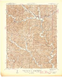
1946 Map of Lesterville
USGS Topo · Published 1946About this map
Lesterville and Centerville serve as the primary hubs in this mid-century portrait of Reynolds County, situated at the confluence of the West Fork and East Fork of the Black River. The landscape is defined by deep, winding hollows and family-named landmarks, reflecting an era of small, self-contained communities. Numerous rural institutions are documented, including Pleasant Hill Ch and several local schools like Gladdendale Sch and Peola Sch.
Find a feature on this map
85 named features on this map. Tap any name to fly to it.
Don’t see what you’re looking for? This feature index may not catch every label — zoom into the map to look around manually.
Map Details
Editions of this 1946 Lesterville Map
2 editions found

Other maps of this area

1924 · Edgehill
USGS Topo · 1:62,500

1926 · Edgehill
USGS Topo · 1:62,500

1926 · Des Arc
USGS Topo · 1:62,500

1928 · Cardareva
USGS Topo · 1:62,500

1929 · Des Arc
USGS Topo · 1:62,500

1932 · Piedmont
USGS Topo · 1:62,500

1935 · Piedmont
USGS Topo · 1:62,500

1937 · Ironton
USGS Topo · 1:48,000

1943 · Ellington
USGS Topo · 1:62,500

1943 · Lesterville
USGS Topo · 1:62,500