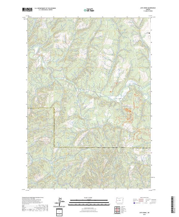
2023 Map of Letz Creek
USGS Topo · Published 2023About this map
The Siuslaw River and its numerous tributaries dominate this drainage-rich landscape in the Coast Range along the border of Douglas and Lane counties. This 2023 survey documents a terrain defined by complex timber management and recreational infrastructure, where Bureau of Land Management roads like BLM RD 20-6-2 provide access to the deep interior. The map captures the meeting of the Siuslaw River and its South Fork, alongside significant waterways like the Smith River and Little Siuslaw Creek. Cultural landmarks are centered near the northeast corner, notably the Lorane Grange Cem and Lake Louise. Modern usage is represented through specialized networks like the Tyrell Forest Succession Trl and the Carpenter Bypass Mtn Bike Trl, showing how former logging corridors have been repurposed for conservation and mountain biking.
Find a feature on this map
57 named features on this map. Tap any name to fly to it.
Don’t see what you’re looking for? This feature index may not catch every label — zoom into the map to look around manually.
Map Details
Editions of this 2023 Letz Creek Map
This is the sole edition of this map. No revisions or reprints were ever made.
Other maps of this area

1921 · Cottage Grove
USGS Topo · 1:62,500

1942 · Crow
USGS Topo · 1:62,500

1945 · Crow
USGS Topo · 1:62,500

1954 · Drain
USGS Topo · 1:62,500

1954 · Anlauf
USGS Topo · 1:62,500
1957 · Cottage Grove
USGS Topo · 1:62,500

1958 · Roseburg
USGS Topo · 1:250,000

1959 · Roseburg
USGS Topo · 1:250,000

1979 · Cottage Grove
USGS Topo · 1:100,000
1984 · High Point
USGS Topo · 1:24,000