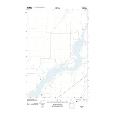
2011 Map of Levey
USGS Topo · Published 2011About this map
Lake Sacajawea dominates the southern landscape of this Franklin County quadrangle, where the river narrows and winds toward the settlements of Levey and Ash. In this 2011 survey, the agricultural and transport network is defined by long, straight thoroughfares like Pasco Kahlotus Rd and Page Rd, which connect the interior plateau to the riverbank. Smaller water bodies, including Emma Lake and Dalton Lake, are situated along the eastern bluffs, suggesting the complex drainage and irrigation patterns characteristic of the region. The small settlement of Redd sits atop the heights overlooking the water, marking a quiet point of human presence in a landscape shaped by large-scale hydrological management and rural infrastructure.
Find a feature on this map
17 named features on this map. Tap any name to fly to it.
Don’t see what you’re looking for? This feature index may not catch every label — zoom into the map to look around manually.
Map Details
Editions of this 2011 Levey Map
This is the sole edition of this map. No revisions or reprints were ever made.
Other maps of this area

1915 · Wallulah
USGS Topo · 1:96,000

1918 · Wallula
USGS Topo · 1:125,000

1953 · Walla Walla
USGS Topo · 1:250,000

1958 · Walla Walla
USGS Topo · 1:250,000

1963 · Rye Grass Coulee
USGS Topo · 1:24,000

1964 · Levey SW
USGS Topo · 1:24,000

1964 · Levey SE
USGS Topo · 1:24,000

1964 · Slater
USGS Topo · 1:24,000

1964 · Levey NE
USGS Topo · 1:24,000

1964 · Humorist
USGS Topo · 1:24,000