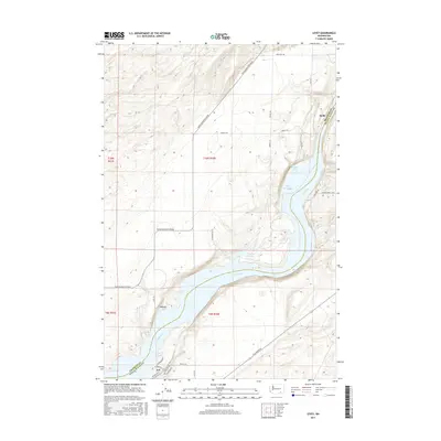
2017 Map of Levey
USGS Topo · Published 2017About this map
The Snake River defines the landscape of this region, winding through the boundary between Franklin Co and Walla Walla Co. At this point in time, the river's flow is characterized by large pooled bodies of water such as Lake Sacajawea, which dominates the eastern portion of the map. Small settlements and staging points like Levey, Redd, and Ash provide evidence of human activity along the river's banks and the adjacent plateaus. Inland, the terrain is marked by seasonal or permanent water features like Emma Lake and Dalton Lake. The transportation network is anchored by Pasco Kahlotus Road and Ice Harbor Dr, while localized development is visible in the residential street patterns near Charbonneau Dr and Lakeview Dr on the southern shore.
Find a feature on this map
30 named features on this map. Tap any name to fly to it.
Don’t see what you’re looking for? This feature index may not catch every label — zoom into the map to look around manually.
Map Details
Editions of this 2017 Levey Map
This is the sole edition of this map. No revisions or reprints were ever made.
Other maps of this area

1915 · Wallulah
USGS Topo · 1:96,000

1918 · Wallula
USGS Topo · 1:125,000

1953 · Walla Walla
USGS Topo · 1:250,000

1958 · Walla Walla
USGS Topo · 1:250,000

1963 · Rye Grass Coulee
USGS Topo · 1:24,000

1964 · Levey SW
USGS Topo · 1:24,000

1964 · Levey SE
USGS Topo · 1:24,000

1964 · Slater
USGS Topo · 1:24,000

1964 · Levey NE
USGS Topo · 1:24,000

1964 · Humorist
USGS Topo · 1:24,000