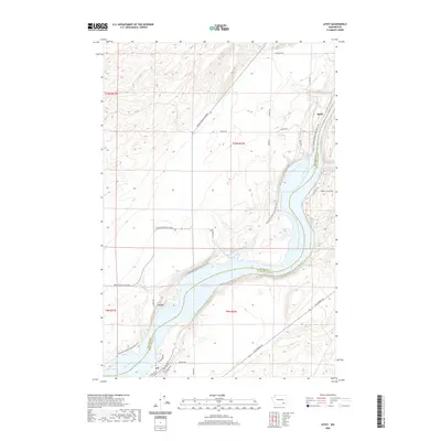
2020 Map of Levey
USGS Topo · Published 2020About this map
Lake Sacajawea dominates the southern half of this landscape, formed by the impoundment of the Snake River as it winds along the border of Franklin and Walla Walla counties. The small settlement of Levey sits near the northern shore, while Redd occupies a narrow strip of land to the northeast, pinched between the river and rising bluffs. This 2020 map documents a modern riverfront environment where recreational infrastructure, such as the Columbia Plateau State Park Trail, follows the path of former transportation corridors. Local access is provided by a network of roads including Pasco Kahlotus Road and Ice Harbor Dr, which serve the small communities and agricultural lands above the river canyon. The landscape transitions from the riparian zone at Ash to the higher plateaus marked by features like Mcclenny Rd and Fish Hook Rd.
Find a feature on this map
28 named features on this map. Tap any name to fly to it.
Don’t see what you’re looking for? This feature index may not catch every label — zoom into the map to look around manually.
Map Details
Editions of this 2020 Levey Map
This is the sole edition of this map. No revisions or reprints were ever made.
Other maps of this area

1915 · Wallulah
USGS Topo · 1:96,000

1918 · Wallula
USGS Topo · 1:125,000

1953 · Walla Walla
USGS Topo · 1:250,000

1958 · Walla Walla
USGS Topo · 1:250,000

1963 · Rye Grass Coulee
USGS Topo · 1:24,000

1964 · Levey SW
USGS Topo · 1:24,000

1964 · Levey SE
USGS Topo · 1:24,000

1964 · Slater
USGS Topo · 1:24,000

1964 · Levey NE
USGS Topo · 1:24,000

1964 · Humorist
USGS Topo · 1:24,000