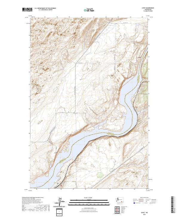
2023 Map of Levey
USGS Topo · Published 2023About this map
The Snake River dominates this landscape on the border of Franklin and Walla Walla counties, carving a deep blue corridor through the arid plateau. The northern portion of the map is defined by the Juniper Dunes Wilderness, a protected area of rolling sand and vegetation that contrasts with the developed riverbank below. Small riverside settlements including Levey, Ash, and Redd trace the water’s edge, linked by the Columbia Plateau State Park Trl. This corridor reflects a modern utility-focused landscape where transportation routes like Pasco Kahlotus Road and Ice Harbor Dr serve the rural agricultural and river-access points. The map reveals how the steep bluffs along the river confine human activity to narrow strips between the high desert plateaus and the water.
Find a feature on this map
30 named features on this map. Tap any name to fly to it.
Don’t see what you’re looking for? This feature index may not catch every label — zoom into the map to look around manually.
Map Details
Editions of this 2023 Levey Map
This is the sole edition of this map. No revisions or reprints were ever made.
Other maps of this area

1915 · Wallulah
USGS Topo · 1:96,000

1918 · Wallula
USGS Topo · 1:125,000

1953 · Walla Walla
USGS Topo · 1:250,000

1958 · Walla Walla
USGS Topo · 1:250,000

1963 · Rye Grass Coulee
USGS Topo · 1:24,000

1964 · Levey SW
USGS Topo · 1:24,000

1964 · Levey SE
USGS Topo · 1:24,000

1964 · Slater
USGS Topo · 1:24,000

1964 · Levey NE
USGS Topo · 1:24,000

1964 · Humorist
USGS Topo · 1:24,000