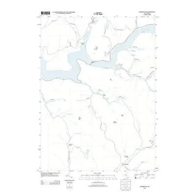
2013 Map of Lewbeach
USGS Topo · Published 2013About this map
Pepacton Reservoir dominates the northern landscape of this region, its waters inundating several historical valley floors and providing a sharp contrast to the surrounding elevations. The settlement of Lewbeach serves as a southern anchor near the winding course of the Beaver Kill, while numerous named hollows like Hendricks Hollow, Whitcomb Hollow, and Shaver Hollow reveal the intricate network of narrow valleys and secondary roads that define local geography.
Find a feature on this map
66 named features on this map. Tap any name to fly to it.
Don’t see what you’re looking for? This feature index may not catch every label — zoom into the map to look around manually.
Map Details
Editions of this 2013 Lewbeach Map
This is the sole edition of this map. No revisions or reprints were ever made.
Other maps of this area

1901 · Margaretville
USGS Topo · 1:62,500

1904 · Margaretville
USGS Topo · 1:62,500

1910 · Neversink
USGS Topo · 1:62,500

1921 · Livingston Manor
USGS Topo · 1:62,500

1922 · Andes
USGS Topo · 1:62,500

1923 · Livingston Manor
USGS Topo · 1:62,500

1924 · Andes
USGS Topo · 1:62,500

1942 · Neversink
USGS Topo · 1:62,500

1943 · Monticello
USGS Topo · 1:125,000

1944 · Livingston Manor
USGS Topo · 1:62,500