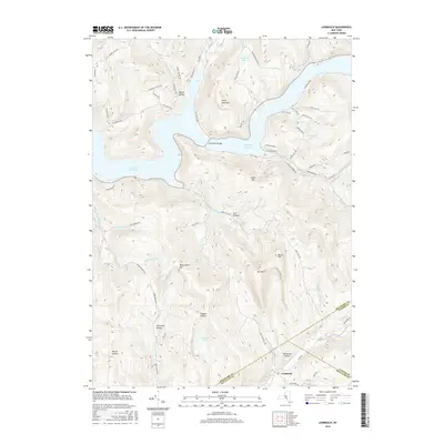
2016 Map of Lewbeach
USGS Topo · Published 2016About this map
Pepacton Reservoir dominates the northern landscape of this region, its waters filling the valley where the East Branch Delaware River once flowed. The 2016 survey illustrates the modern topography of this Catskill Mountain area, centered on the tri-county corner where Delaware, Ulster, and Sullivan counties meet. This intersection is marked by the hamlet of Lewbeach on the Beaver Kill, a legendary trout stream that defines the southern portion of the map. High peaks and deep valleys like Pelnor Hollow and Huggins Hollow characterize the terrain between the reservoir and the river. Significant elevation changes are evident from Perch Lake Mtn down to the shoreline, while the Shavertown Bridge provides a vital crossing over the reservoir's central reach, linking roads like NYC Route 30A to the southern hills.
Find a feature on this map
72 named features on this map. Tap any name to fly to it.
Don’t see what you’re looking for? This feature index may not catch every label — zoom into the map to look around manually.
Map Details
Editions of this 2016 Lewbeach Map
This is the sole edition of this map. No revisions or reprints were ever made.
Other maps of this area

1901 · Margaretville
USGS Topo · 1:62,500

1904 · Margaretville
USGS Topo · 1:62,500

1910 · Neversink
USGS Topo · 1:62,500

1921 · Livingston Manor
USGS Topo · 1:62,500

1922 · Andes
USGS Topo · 1:62,500

1923 · Livingston Manor
USGS Topo · 1:62,500

1924 · Andes
USGS Topo · 1:62,500

1942 · Neversink
USGS Topo · 1:62,500

1943 · Monticello
USGS Topo · 1:125,000

1944 · Livingston Manor
USGS Topo · 1:62,500