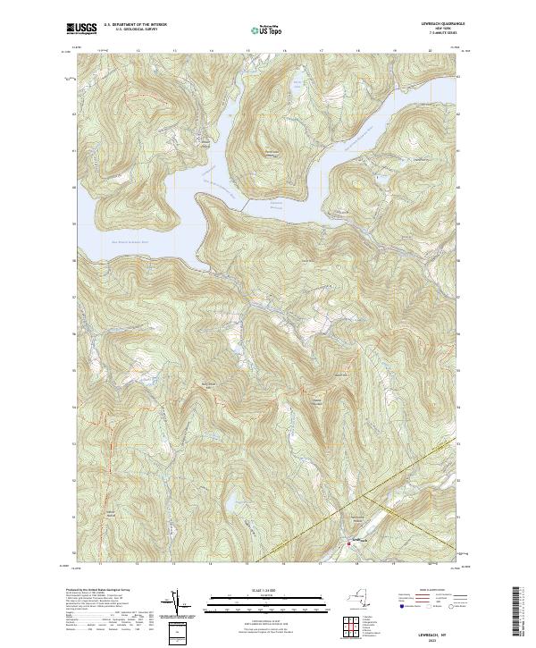
2023 Map of Lewbeach
USGS Topo · Published 2023About this map
The Pepacton Reservoir dominates the northern half of this landscape, created by the damming of the East Branch Delaware River to serve New York City’s water supply. The map captures the steep terrain of the Catskills, where deep-cut valleys like Shaver Hollow and Gun Hollow descend toward the water. To the south, the settlement of Lewbeach sits near the winding course of the Beaver Kill, a legendary waterway for fly fishing.
Find a feature on this map
80 named features on this map. Tap any name to fly to it.
Don’t see what you’re looking for? This feature index may not catch every label — zoom into the map to look around manually.
Map Details
Editions of this 2023 Lewbeach Map
This is the sole edition of this map. No revisions or reprints were ever made.
Other maps of this area

1901 · Margaretville
USGS Topo · 1:62,500

1904 · Margaretville
USGS Topo · 1:62,500

1910 · Neversink
USGS Topo · 1:62,500

1921 · Livingston Manor
USGS Topo · 1:62,500

1922 · Andes
USGS Topo · 1:62,500

1923 · Livingston Manor
USGS Topo · 1:62,500

1924 · Andes
USGS Topo · 1:62,500

1942 · Neversink
USGS Topo · 1:62,500

1943 · Monticello
USGS Topo · 1:125,000

1944 · Livingston Manor
USGS Topo · 1:62,500