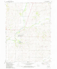
1971 Map of Lewis
USGS Topo · Published 1983About this map
The town of Lewis serves as the central hub of this Cass County landscape, situated along the eastern banks of the Nishnabotna River. The mapping captures a period of established local infrastructure, including the County Home in the northern hills and the Oakwood Cem just north of the town site. The river valley is a defining feature of the topography, bordered by the Cold Springs State Park, which includes both the namesake Cold Springs and a campground for recreation. Outside the residential blocks of Lewis, the land is marked by agricultural use and small-scale industrial sites like the Gravel Pit near Spring Creek. Numerous waterways, including Turkey Creek, Bear Branch, and Sevenmile Creek, carve through the surrounding townships of Washington, Grove, and Bear Grove, illustrating the complex drainage patterns that shaped the county’s rural development.
Find a feature on this map
20 named features on this map. Tap any name to fly to it.
Don’t see what you’re looking for? This feature index may not catch every label — zoom into the map to look around manually.
Map Details
Editions of this 1971 Lewis Map
2 editions found
Other maps of this area

1954 · Omaha
USGS Topo · 1:250,000

1957 · Omaha
USGS Topo · 1:250,000

1958 · Omaha
USGS Topo · 1:250,000

1971 · Walnut
USGS Topo · 1:24,000

1971 · Wiota
USGS Topo · 1:24,000

1971 · Atlantic
USGS Topo · 1:24,000

1971 · Atlantic SW
USGS Topo · 1:24,000

1971 · Anita SW
USGS Topo · 1:24,000

1971 · Lewis
USGS Topo · 1:24,000

1978 · Griswold
USGS Topo · 1:24,000