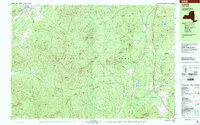
1999 Map of Lewis
USGS Topo · Published 2000About this map
The Adirondack Park dominates this late-century landscape, where the high peaks of the Jay Mountains and the Soda Range define the rugged topography of Essex County. Settlement is concentrated along the valleys, with the hamlet of Lewis situated near the Boquet River and the small community of Deerhead to the north. The area's transit is anchored by the Adirondack Northway, which cuts a modern path through the wilderness, contrasting with the established local routes that connect historic sites like Central Cemetery and Fairview Cem.
Find a feature on this map
118 named features on this map. Tap any name to fly to it.
Don’t see what you’re looking for? This feature index may not catch every label — zoom into the map to look around manually.
Map Details
Editions of this 1999 Lewis Map
This is the sole edition of this map. No revisions or reprints were ever made.
Other maps of this area

1894 · Elizabethtown
USGS Topo · 1:62,500

1894 · Port Henry
USGS Topo · 1:62,500

1895 · Willsboro
USGS Topo · 1:62,500

1895 · Elizabethtown
USGS Topo · 1:62,500

1895 · Mt. Marcy
USGS Topo · 1:62,500

1895 · Ausable
USGS Topo · 1:62,500

1896 · Lake Placid
USGS Topo · 1:62,500

1898 · Port Henry
USGS Topo · 1:62,500

1898 · Lake Placid
USGS Topo · 1:62,500

1901 · Elizabethtown
USGS Topo · 1:62,500