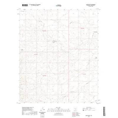
2023 Map of Lewis Peak NE
USGS Topo · Published 2023About this map
Pretty Bird Hills and a complex network of arroyos characterize this portion of Chaves County, where the high desert terrain is etched by seasonal watercourses. The landscape is defined by significant drainage systems such as Walnut Draw, Fourmile Canyon, and Pretty Bird Canyon, which illustrate the natural erosive patterns of the region. Human imprint on this arid environment is primarily restricted to rural access routes like Cauhape Ranch Rd and Russel Gap Rd, reflecting a landscape dedicated to ranching and wide-open rangeland. The map detail highlights the intersection of several townships, including t18s r18e and t19s r19e, providing a precise look at the land partitions and topography of the New Mexico backcountry in the early 21st century.
Find a feature on this map
16 named features on this map. Tap any name to fly to it.
Don’t see what you’re looking for? This feature index may not catch every label — zoom into the map to look around manually.
Map Details
Editions of this 2023 Lewis Peak NE Map
This is the sole edition of this map. No revisions or reprints were ever made.
Other maps of this area

1954 · Carlsbad
USGS Topo · 1:250,000

1958 · Carlsbad
USGS Topo · 1:250,000

1960 · Teel Ranch
USGS Topo · 1:62,500

1962 · Dunken
USGS Topo · 1:62,500

1965 · Lewis Peak NE
USGS Topo · 1:24,000

1965 · Lewis Peak
USGS Topo · 1:24,000

1965 · Bullis Spring Ranch
USGS Topo · 1:24,000

1965 · Pinon Ranch
USGS Topo · 1:24,000

1978 · Encino Draw
USGS Topo · 1:24,000

1978 · Artesia
USGS Topo · 1:100,000