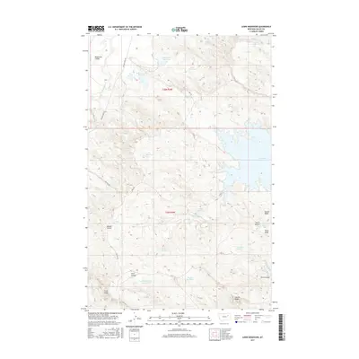
2017 Map of Lewis Reservoir
USGS Topo · Published 2017About this map
Fort Peck Lake defines the eastern edge of this landscape in Valley County, Montana, where the prairie breaks into a complex system of ridges and coulees. The high ground is marked by features such as Second Ridge and Third Ridge, which overlook a network of seasonal drainages and human-made water catchments. These reservoirs, including Willow-Flat Reservoir, Lewis Reservoir, and the curiously named Lost McMehoney Reservoir, suggest a landscape managed for livestock and water conservation in an arid environment. Transportation through this remote terrain is limited to rugged routes like The Pines Rd and Willow Creek Rd, which navigate between prominent landforms like Bomber Coulee and Fifth Ridge. The transition from the high plateau down toward the massive reservoir at the east illustrates the typical topography of the Missouri River breaks region.
Find a feature on this map
36 named features on this map. Tap any name to fly to it.
Don’t see what you’re looking for? This feature index may not catch every label — zoom into the map to look around manually.
Map Details
Editions of this 2017 Lewis Reservoir Map
This is the sole edition of this map. No revisions or reprints were ever made.
Other maps of this area

1943 · Glasgow
USGS Topo · 1:125,000

1954 · Jordan
USGS Topo · 1:250,000

1954 · Glasgow
USGS Topo · 1:250,000

1956 · Jordan
USGS Topo · 1:250,000

1957 · Glasgow
USGS Topo · 1:250,000

1958 · Glasgow
USGS Topo · 1:250,000

1958 · Jordan
USGS Topo · 1:250,000

1958 · Miller Coulee
USGS Topo · 1:62,500

1958 · Collins Ranch
USGS Topo · 1:62,500

1958 · Lewis Reservoir
USGS Topo · 1:24,000