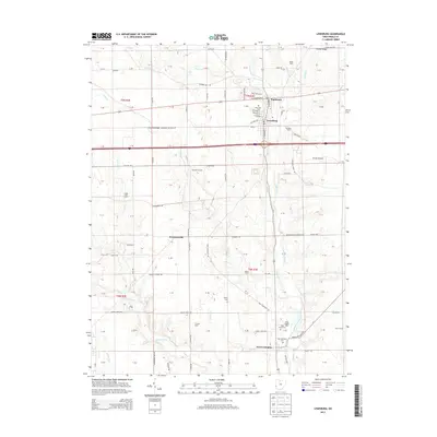
2013 Map of Lewisburg
USGS Topo · Published 2013About this map
Lewisburg and Euphemia sit at the intersection of local industry and agriculture in Preble County, positioned north of the older settlement at New Lexington. The landscape is defined by the winding course of Twin Creek and its many tributaries, including Bantas Fork, Price Creek, and Lowry Run. This hydrology supported early settlement patterns, reflected in the numerous family-named agricultural plots such as Baker Farm, Demotte Farm, and Odiam Farms that dot the countryside. Historic infrastructure is noted at the Warnke Bridge and the Geeting Bridge, crossing the waterways that feed the region's fertile soils. Genealogists will find significant value in the distribution of burial grounds across the townships, from the centrally located Roselawn Cem to the outlying Myers Cem and New Lexington Cem. The presence of the Gilmer Airport and the local Po in Lewisburg mark the modern centers of commerce and transport within this long-established farming community.
Find a feature on this map
73 named features on this map. Tap any name to fly to it.
Don’t see what you’re looking for? This feature index may not catch every label — zoom into the map to look around manually.
Map Details
Editions of this 2013 Lewisburg Map
This is the sole edition of this map. No revisions or reprints were ever made.
Other maps of this area

1905 · Brookville
USGS Topo · 1:62,500

1908 · Miamisburg
USGS Topo · 1:62,500

1911 · Oxford
USGS Topo · 1:62,500

1953 · Cincinnati
USGS Topo · 1:250,000

1957 · Cincinnati
USGS Topo · 1:250,000

1960 · New Madison
USGS Topo · 1:24,000
1960 · Eaton North
USGS Topo · 1:24,000

1960 · Farmersville
USGS Topo · 1:24,000
1960 · Eaton South
USGS Topo · 1:24,000

1961 · Laura
USGS Topo · 1:24,000