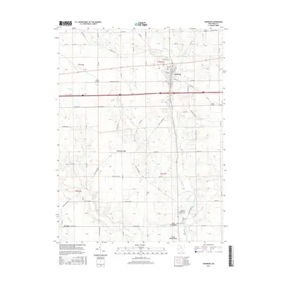
2016 Map of Lewisburg
USGS Topo · Published 2016About this map
Lewisburg serves as a primary hub in this portion of Preble County, situated at the confluence of several regional routes including the New Lexington Salem Rd and Salem Rd. The landscape is defined by the winding path of Twin Cr and its numerous tributaries, including Millers Fork, Lick Run, and Jims Run. These waterways historically dictated the placement of early infrastructure, evidenced by the Warnke Bridge and Geeting Bridge.
Find a feature on this map
61 named features on this map. Tap any name to fly to it.
Don’t see what you’re looking for? This feature index may not catch every label — zoom into the map to look around manually.
Map Details
Editions of this 2016 Lewisburg Map
This is the sole edition of this map. No revisions or reprints were ever made.
Other maps of this area

1905 · Brookville
USGS Topo · 1:62,500

1908 · Miamisburg
USGS Topo · 1:62,500

1911 · Oxford
USGS Topo · 1:62,500

1953 · Cincinnati
USGS Topo · 1:250,000

1957 · Cincinnati
USGS Topo · 1:250,000

1960 · New Madison
USGS Topo · 1:24,000
1960 · Eaton North
USGS Topo · 1:24,000

1960 · Farmersville
USGS Topo · 1:24,000
1960 · Eaton South
USGS Topo · 1:24,000

1961 · Laura
USGS Topo · 1:24,000