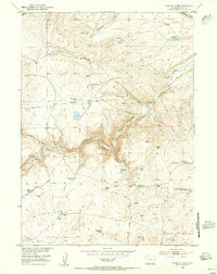
1953 Map of Lewiston Lakes
USGS Topo · Published 1955About this map
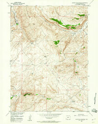
The Sweetwater River winds through this mid-century landscape of south-central Wyoming, carving a deep valley that historically guided western migration. Traces of the Oregon Trail are clearly marked along the northern banks, moving past McLean Meadows and the small bodies of water known as Lewiston Lakes. The area is defined by a network of seasonal water sources and springs essential for high-country livestock grazing, including Diamond Springs, Immigrant Springs, and both Upper Mormon Spring and Lower Mormon Spring. Cultural landmarks like Canoys Cabin and the Yellowstone Cow Camp reflect the ranching heritage of the Antelope Hills region. To the north, Beaver Rim provides a sharp geological boundary, while drainage systems like Strawberry Creek and Willow Creek feed into the primary river valley below.
Find a feature on this map
29 named features on this map. Tap any name to fly to it.
Don’t see what you’re looking for? This feature index may not catch every label — zoom into the map to look around manually.
Map Details
Editions of this 1953 Lewiston Lakes Map
4 editions found
Other maps of this area

1953 · Lewiston Lakes
USGS Topo · 1:24,000

1953 · Barras Springs
USGS Topo · 1:24,000

1953 · Gravel Spring
USGS Topo · 1:24,000

1953 · Radium Springs
USGS Topo · 1:24,000

1953 · Schlichting Mountain
USGS Topo · 1:24,000

1953 · Red Canyon
USGS Topo · 1:24,000

1955 · Lander
USGS Topo · 1:250,000
1957 · Red Canyon
USGS Topo · 1:24,000

1958 · Lander
USGS Topo · 1:250,000
1958 · Schoettlin Mountain
USGS Topo · 1:24,000