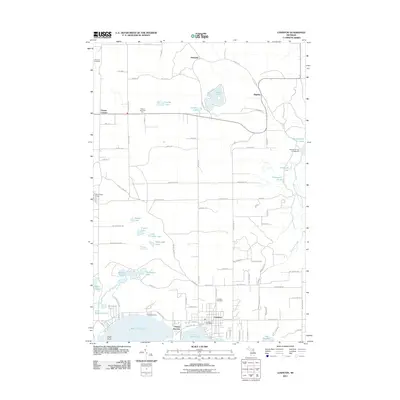
2011 Map of Lewiston
USGS Topo · Published 2011About this map
Lewiston serves as the primary hub of this lakeside region, situated at the junction of West Twin Lake and East Twin Lake. The town layout includes the Lewiston Post Office and Lewiston Cemetery, while the northern reaches of the township are defined by smaller settlements like Donnelly and Bigelow. The presence of the Vienna Township Hall at Vienna Corners indicates the civic center for the surrounding rural area, which is heavily interspersed with named water bodies such as Gaylanta Lake and Lunden Lake.
Find a feature on this map
95 named features on this map. Tap any name to fly to it.
Don’t see what you’re looking for? This feature index may not catch every label — zoom into the map to look around manually.
Map Details
Editions of this 2011 Lewiston Map
This is the sole edition of this map. No revisions or reprints were ever made.
Other maps of this area

1949 · Lewiston
USGS Topo · 1:62,500

1950 · Lewiston
USGS Topo · 1:24,000

1950 · Comstock Hills
USGS Topo · 1:24,000

1950 · Johannesburg
USGS Topo · 1:24,000

1950 · Lovells
USGS Topo · 1:24,000

1951 · Comstock Hills
USGS Topo · 1:24,000

1951 · Lovells
USGS Topo · 1:24,000

1951 · Johannesburg
USGS Topo · 1:24,000

1951 · Lewiston
USGS Topo · 1:24,000

1954 · Hetherton
USGS Topo · 1:62,500