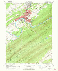
1966 Map of Lewistown
USGS Topo · Published 1968About this map
The industrial and civic core of Lewistown is centered on the confluence of Kishcoquillas Creek and the Junita River, where the Penn Central rail lines and U.S. routes converge. The mid-1960s landscape shows a community built on manufacturing and medical infrastructure, featuring the Municipal Bldg, the Courthouse, and healthcare facilities like Lewistown Hospital and Black Hospital. Educational and religious centers like Chief Logan Sch and Sacred Heart Ch serve the growing residential neighborhoods of Highland Park and Colonial Hills.
Find a feature on this map
71 named features on this map. Tap any name to fly to it.
Don’t see what you’re looking for? This feature index may not catch every label — zoom into the map to look around manually.
Map Details
Editions of this 1966 Lewistown Map
Other maps of this area

1919 · Mattawana
USGS Topo · 1:62,500

1924 · Lewistown
USGS Topo · 1:62,500

1925 · Mifflintown
USGS Topo · 1:48,000

1927 · Lewisburg
USGS Topo · 1:62,500

1930 · Loysville
USGS Topo · 1:62,500

1933 · Loysville
USGS Topo · 1:62,500

1934 · Mifflintown
USGS Topo · 1:62,500

1936 · East Waterford
USGS Topo · 1:48,000

1937 · Mifflintown
USGS Topo · 1:62,500

1941 · East Waterford
USGS Topo · 1:62,500