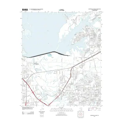
2013 Map of Lewisville East
USGS Topo · Published 2013About this map
Lake Lewisville dominates the northern landscape of this North Texas region, where the Elm Fork Trinity River flows southward through an increasingly suburban corridor. The map details the complex water management and utility infrastructure of the early 21st century, featuring the Lewisville Hatchery and the Lewisville Prairie Creek Wastewater Treatment Facility. This period captures a landscape in transition, where legacy landmarks like Ritter Cem and Cem Hill are surrounded by a dense network of residential streets and arterial roads.
Find a feature on this map
199 named features on this map. Tap any name to fly to it.
Don’t see what you’re looking for? This feature index may not catch every label — zoom into the map to look around manually.
Map Details
Editions of this 2013 Lewisville East Map
This is the sole edition of this map. No revisions or reprints were ever made.
Other maps of this area

1891 · Dallas
USGS Topo · 1:125,000

1893 · Dallas
USGS Topo · 1:125,000

1894 · Fort Worth
USGS Topo · 1:125,000

1925 · Mc Kinney 3-c
USGS Topo · 1:48,000

1925 · Dallas 2-b
USGS Topo · 1:48,000

1929 · Frisco
USGS Topo · 1:62,500

1931 · Carrollton
USGS Topo · 1:62,500

1931 · Grapevine
USGS Topo · 1:62,500

1954 · Dallas
USGS Topo · 1:250,000

1954 · Sherman
USGS Topo · 1:250,000