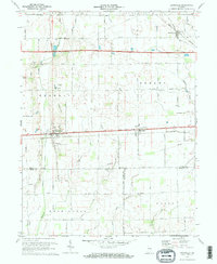
1970 Map of Lewisville
USGS Topo · Published 1973About this map
Lewisville and Straughn sit along the historic National Road in this 1970 survey, which captures the rural landscape of eastern Henry County before modern development. The region is defined by its agricultural grid and the influence of two major rail lines, the Penn Central and the Norfolk and Western, which served the small elevator towns of the era. A network of country churches, including Ebenezer Ch, Salem Ch, and Hopewell Ch, provides crucial landmarks for genealogists and local historians tracing the settlement patterns of Dudley and Franklin townships.
Find a feature on this map
42 named features on this map. Tap any name to fly to it.
Don’t see what you’re looking for? This feature index may not catch every label — zoom into the map to look around manually.
Map Details
Editions of this 1970 Lewisville Map
2 editions found
Other maps of this area

1948 · Lewisville
USGS Topo · 1:24,000

1949 · New Castle West
USGS Topo · 1:24,000

1950 · New Castle East
USGS Topo · 1:24,000

1950 · Dunreith
USGS Topo · 1:24,000

1950 · Lewisville
USGS Topo · 1:24,000

1953 · Cincinnati
USGS Topo · 1:250,000

1956 · Connersville
USGS Topo · 1:24,000

1957 · Cincinnati
USGS Topo · 1:250,000

1959 · Mays
USGS Topo · 1:24,000

1959 · Falmouth
USGS Topo · 1:24,000