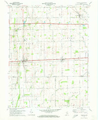
1970 Map of Lewisville
USGS Topo · Published 1973About this map
The National Road and the Penn Central railroad corridor define the central axis of this landscape, anchoring the settlements of Lewisville and Straughn. This area of eastern Indiana shows a structured agricultural pattern organized across township lines, where family-named landmarks like Applebatten Creek and Symons Creek intersect with the grid of country roads. Small rural congregations are prominent across the terrain, including Rich Square Ch, Salem Ch, and Hopewell Ch, reflecting the community-centric development of the mid-20th century.
Find a feature on this map
31 named features on this map. Tap any name to fly to it.
Don’t see what you’re looking for? This feature index may not catch every label — zoom into the map to look around manually.
Map Details
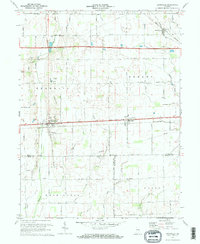
Editions of this 1970 Lewisville Map
2 editions found
Other maps of this area

1948 · Lewisville
USGS Topo · 1:24,000

1949 · New Castle West
USGS Topo · 1:24,000

1950 · New Castle East
USGS Topo · 1:24,000

1950 · Dunreith
USGS Topo · 1:24,000

1950 · Lewisville
USGS Topo · 1:24,000

1953 · Cincinnati
USGS Topo · 1:250,000

1956 · Connersville
USGS Topo · 1:24,000

1957 · Cincinnati
USGS Topo · 1:250,000

1959 · Mays
USGS Topo · 1:24,000

1959 · Falmouth
USGS Topo · 1:24,000