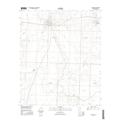
2017 Map of Lewisville
USGS Topo · Published 2017About this map
Lewisville and the neighboring community of Stamps anchor this Lafayette County landscape, where the town grids meet an extensive network of waterways and timberlands. The survey shows the structured street plans of these settlements, including W 8th St and E 1st St, which transition into a rural landscape defined by the winding course of Bodcau Creek. To the southwest, the smaller settlement of Kress City is situated near the natural drainages of Field Bayou and Rawls Cr.
Find a feature on this map
68 named features on this map. Tap any name to fly to it.
Don’t see what you’re looking for? This feature index may not catch every label — zoom into the map to look around manually.
Map Details
Editions of this 2017 Lewisville Map
This is the sole edition of this map. No revisions or reprints were ever made.
Other maps of this area

1952 · Garland
USGS Topo · 1:24,000

1952 · Bradley NE
USGS Topo · 1:24,000

1952 · Old Town
USGS Topo · 1:24,000

1952 · Canfield
USGS Topo · 1:24,000

1952 · Lewisville
USGS Topo · 1:24,000

1952 · Boyd Hill
USGS Topo · 1:24,000

1953 · El Dorado
USGS Topo · 1:250,000

1957 · El Dorado
USGS Topo · 1:250,000

1958 · El Dorado
USGS Topo · 1:250,000

1960 · El Dorado
USGS Topo · 1:250,000