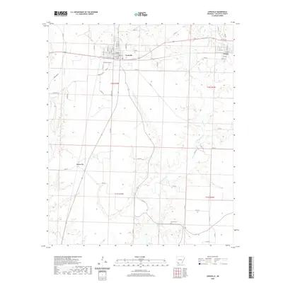
2020 Map of Lewisville
USGS Topo · Published 2020About this map
Lewisville serves as a focal point of this Lafayette County landscape, anchored by the Lafayette County Courthouse and a grid of streets including Chestnut St and Battle St. The settlement pattern follows the local geography of the Red River Valley, with the town positioned near the confluence of Battle Cr and other small tributaries. To the southeast, the terrain transitions into the wetlands and meandering paths of Bodcau Creek, which dominates the hydrology of the eastern half of the map.
Find a feature on this map
64 named features on this map. Tap any name to fly to it.
Don’t see what you’re looking for? This feature index may not catch every label — zoom into the map to look around manually.
Map Details
Editions of this 2020 Lewisville Map
This is the sole edition of this map. No revisions or reprints were ever made.
Other maps of this area

1952 · Garland
USGS Topo · 1:24,000

1952 · Bradley NE
USGS Topo · 1:24,000

1952 · Old Town
USGS Topo · 1:24,000

1952 · Canfield
USGS Topo · 1:24,000

1952 · Lewisville
USGS Topo · 1:24,000

1952 · Boyd Hill
USGS Topo · 1:24,000

1953 · El Dorado
USGS Topo · 1:250,000

1957 · El Dorado
USGS Topo · 1:250,000

1958 · El Dorado
USGS Topo · 1:250,000

1960 · El Dorado
USGS Topo · 1:250,000