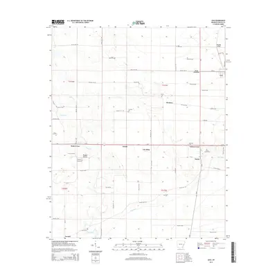
2014 Map of Lexa
USGS Topo · Published 2014About this map
Lexa and its surrounding Phillips County hamlets are revealed in this 2014 study of the Arkansas Delta. The settlement pattern follows a network of rural routes such as Phillips 258 Rd, connecting established communities like Poplar Grove, Barton, and Trenton. Genealogical interest is particularly high given the numerous burial grounds scattered across the township lines of t1s r2e and t2s r3e, including Saint James Cem, Central Cem, and the uniquely named Hell Cem. The landscape is defined by the intersection of local commerce and transit at Lexa Junction and residential clusters such as Lake Ridge and Blackfoot. These small settlements, often located at crossroads like Walnut Corner and Maple Corner, illustrate the persistent, decentralized agricultural community structure of the region in the early 21st century.
Find a feature on this map
26 named features on this map. Tap any name to fly to it.
Don’t see what you’re looking for? This feature index may not catch every label — zoom into the map to look around manually.
Map Details
Editions of this 2014 Lexa Map
This is the sole edition of this map. No revisions or reprints were ever made.
Other maps of this area

1939 · Farrell
USGS Topo · 1:62,500

1939 · Modoc
USGS Topo · 1:62,500

1939 · Latour
USGS Topo · 1:62,500

1940 · Marvell
USGS Topo · 1:62,500

1948 · Helena
USGS Topo · 1:250,000

1948 · Modoc
USGS Topo · 1:62,500

1950 · Helena
USGS Topo · 1:250,000

1955 · Latour
USGS Topo · 1:62,500
1955 · Farrell
USGS Topo · 1:62,500

1955 · Helena
USGS Topo · 1:250,000