2024 Map of Lexa
USGS Topo · Published 2024About this map
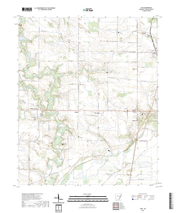
The agricultural landscape of Phillips County is defined by its network of rural settlements and small family burial grounds. Centered on the town of Lexa, this area includes nearby North Lexa and Lexa Junction, where local roads like Phillips Road 258 and Phillips Road 252 connect farming communities. The map highlights numerous historical cemeteries, including Saint Johns Cem, Saint James Cem, and the uniquely named Hell Cem, which serve as vital landmarks for local genealogical research.
Find a feature on this map
67 named features on this map. Tap any name to fly to it.
Don’t see what you’re looking for? This feature index may not catch every label — zoom into the map to look around manually.
Map Details
Editions of this 2024 Lexa Map
This is the sole edition of this map. No revisions or reprints were ever made.