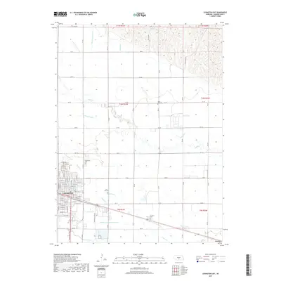
2017 Map of Lexington East
USGS Topo · Published 2017About this map
The eastern edges of Lexington and the surrounding agricultural landscape define this 2017 survey of Dawson County. The Platte River valley's complex water management system is prominently displayed through a network of irrigation and drainage infrastructure, including the Dawson County Canal, Beatty Ditch, and Dawson County Drain Number 1. These man-made channels run alongside natural watercourses like Buffalo Cr and Spring Cr, illustrating the intensive engineering required to support the region's farming economy.
Find a feature on this map
87 named features on this map. Tap any name to fly to it.
Don’t see what you’re looking for? This feature index may not catch every label — zoom into the map to look around manually.
Map Details
Editions of this 2017 Lexington East Map
This is the sole edition of this map. No revisions or reprints were ever made.
Other maps of this area

1896 · Lexington
USGS Topo · 1:125,000

1899 · Lexington
USGS Topo · 1:125,000

1955 · Grand Island
USGS Topo · 1:250,000

1957 · Grand Island
USGS Topo · 1:250,000

1958 · Grand Island
USGS Topo · 1:250,000

1962 · Lexington West
USGS Topo · 1:24,000

1962 · Lexington SE
USGS Topo · 1:24,000
1962 · Buffalo
USGS Topo · 1:24,000
1962 · Sumner
USGS Topo · 1:24,000

1962 · Lexington East
USGS Topo · 1:24,000