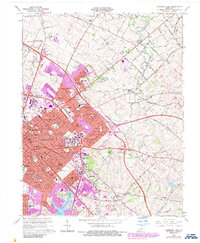
1965 Map of Lexington East
USGS Topo · Published 1987About this map
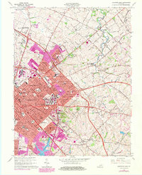
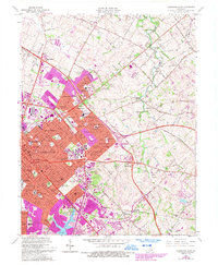
The University of Kentucky and Transylvania University anchor the urban core of Lexington, where residential expansion meets the Bluegrass region's traditional thoroughbred landscape. By the mid-1960s, the city's growth pushed eastward into a network of newly established neighborhoods like Thoroughbred Acres, Kenwood, and Shadeland. This suburban development is bounded by the arc of New Circle Road, which separates the dense city streets from the larger estates and horse-related landmarks of Fayette County. North and east of the city, the landscape retains its agricultural character along North Elkhorn Creek, dotted with family burial grounds such as Horse Cem and Howards Grove Cem. The presence of the Eastern State Hospital and the expansive University of Kentucky Agricultural Experimental Station highlights the importance of institutional land use during this era of rapid municipal transition.
Find a feature on this map
84 named features on this map. Tap any name to fly to it.
Don’t see what you’re looking for? This feature index may not catch every label — zoom into the map to look around manually.
Map Details
Editions of this 1965 Lexington East Map
6 editions found
Other maps of this area

1892 · Richmond
USGS Topo · 1:125,000

1897 · Richmond
USGS Topo · 1:125,000

1905 · Harrodsburg
USGS Topo · 1:125,000

1906 · Georgetown
USGS Topo · 1:62,500

1908 · Georgetown
USGS Topo · 1:62,500

1927 · Lexington
USGS Topo · 1:48,000

1929 · Lexington
USGS Topo · 1:62,500

1950 · Lexington East
USGS Topo · 1:24,000

1950 · Lexington West
USGS Topo · 1:24,000

1952 · Nicholasville
USGS Topo · 1:24,000