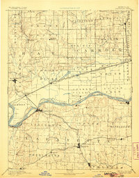
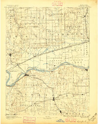
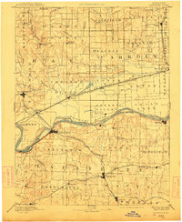
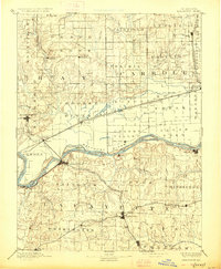
1889 Map of Lexington
USGS Topo · Published 1906About this map
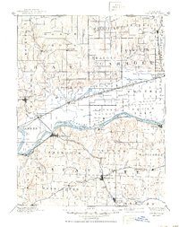
The Missouri River bisects this late nineteenth-century landscape, carving a wide valley between the bluff-top settlements of Lexington and Richmond. This reconnaissance survey highlights a critical era of transition as the Missouri River Compiled from Surveys made in 1879 by the Engineer Corps U.S. Army is integrated into the topographic study. The river corridor is complex, featuring prominent landforms like Lexington Island and Wolf Island tucked between shifting banks near Wellington.
Find a feature on this map
89 named features on this map. Tap any name to fly to it.
Don’t see what you’re looking for? This feature index may not catch every label — zoom into the map to look around manually.
Map Details
Editions of this 1889 Lexington Map
6 editions found
Other maps of this area

1885 · Warrensburg
USGS Topo · 1:125,000

1887 · Harrisonville
USGS Topo · 1:125,000

1887 · Sedalia
USGS Topo · 1:125,000

1887 · Warrensburg
USGS Topo · 1:125,000

1889 · Lexington
USGS Topo · 1:125,000

1890 · Marshall
USGS Topo · 1:125,000

1892 · Marshall
USGS Topo · 1:125,000

1892 · Harrisonville
USGS Topo · 1:125,000

1894 · Harrisonville
USGS Topo · 1:125,000

1894 · Sedalia
USGS Topo · 1:125,000