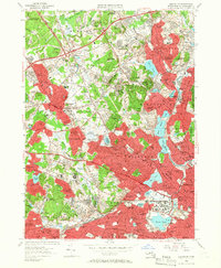
1956 Map of Lexington
USGS Topo · Published 1956About this map
Middlesex County suburban expansion is in full view here during the mid-1950s, showing the dense residential growth patterns between Lexington and Arlington. The landscape is a mix of traditional New England town centers and large institutional grounds, notably the sprawling Metropolitan State Hospital and Fernald State Sch complexes near the Waltham border. These institutional footprints, alongside the Cambridge Sanatorium and Morton Hospital, occupy significant acreage that would define the region's character for decades.
Find a feature on this map
201 named features on this map. Tap any name to fly to it.
Don’t see what you’re looking for? This feature index may not catch every label — zoom into the map to look around manually.
Map Details
Editions of this 1956 Lexington Map
3 editions found
Other maps of this area

1886 · Lawrence
USGS Topo · 1:62,500

1886 · Lowell
USGS Topo · 1:62,500

1886 · Framingham
USGS Topo · 1:62,500

1888 · Lawrence
USGS Topo · 1:62,500

1889 · Framingham
USGS Topo · 1:62,500

1893 · Lowell
USGS Topo · 1:62,500

1893 · Boston
USGS Topo · 1:62,500

1893 · Lawrence
USGS Topo · 1:62,500

1894 · Framingham
USGS Topo · 1:62,500

1903 · Boston
USGS Topo · 1:62,500