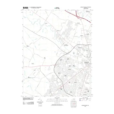
2010 Map of Lexington West
USGS Topo · Published 2010About this map
Lexington's western urban expansion and horse country heritage are captured in this 2010 survey. The landscape transitions from dense residential developments like Gardenside and Beaumont Park to the iconic equine grounds of the Keeneland Race Course. Along the eastern edge, a cluster of significant burial grounds, including the Lexington National Cemetery, Cove Haven Cemetery, and Highland Cemetery, provide essential records for genealogists. The transport infrastructure is dominated by the Blue Grass Airport and a complex web of thoroughfares such as Versailles Rd and New Circle Rd. To the northwest, the terrain opens into historic outlying settlements like Yarnallton, Bracktown, and Little Georgetown, where smaller watercourses such as Town Branch and Steeles Run drain the rolling Bluegrass country. This map documents a modern city that has grown around established agricultural roots and academic institutions like the University of Kentucky Agricultural Experimental Station.
Find a feature on this map
76 named features on this map. Tap any name to fly to it.
Don’t see what you’re looking for? This feature index may not catch every label — zoom into the map to look around manually.
Map Details
Editions of this 2010 Lexington West Map
This is the sole edition of this map. No revisions or reprints were ever made.
Other maps of this area

1892 · Richmond
USGS Topo · 1:125,000

1897 · Richmond
USGS Topo · 1:125,000

1905 · Harrodsburg
USGS Topo · 1:125,000

1906 · Georgetown
USGS Topo · 1:62,500

1908 · Georgetown
USGS Topo · 1:62,500

1927 · Lexington
USGS Topo · 1:48,000

1929 · Lexington
USGS Topo · 1:62,500

1950 · Lexington East
USGS Topo · 1:24,000

1950 · Lexington West
USGS Topo · 1:24,000

1952 · Keene
USGS Topo · 1:24,000
Featured Places
- Lexington, KY
- Cardinal Hill, Lexington
- Highlands, Lexington
- Little Georgetown, Lexington
- Pine Meadows, Lexington