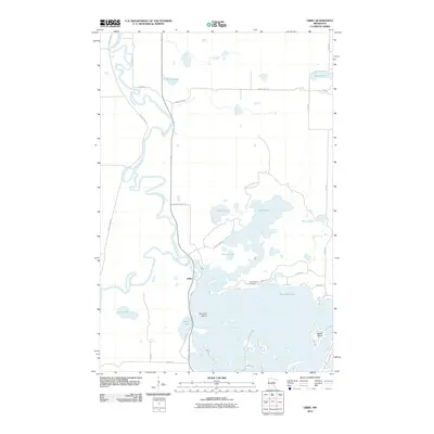
2010 Map of Libby
USGS Topo · Published 2010About this map
The meandering Mississippi River defines the western edge of this landscape, its tight curves and oxbows creating a complex riparian system north of Libby. This area in Aitkin County is a water-rich environment where the Sandy River feeds into the massive Big Sandy Lake, a central feature dotted with landmarks like Emerald Island and Battle Island. The presence of the Tschibegamig Cemetery near the northern shore of the lake provides a significant point of interest for genealogists and local historians, reflecting the long-standing community ties to these shores.
Find a feature on this map
35 named features on this map. Tap any name to fly to it.
Don’t see what you’re looking for? This feature index may not catch every label — zoom into the map to look around manually.
Map Details
Editions of this 2010 Libby Map
This is the sole edition of this map. No revisions or reprints were ever made.
Other maps of this area

1953 · Duluth
USGS Topo · 1:250,000

1958 · Duluth
USGS Topo · 1:250,000

1970 · Tamarack
USGS Topo · 1:24,000

1970 · Rabey
USGS Topo · 1:24,000

1970 · Palisade
USGS Topo · 1:24,000

1970 · Sanders Lake
USGS Topo · 1:24,000
1970 · Vanduse Lake
USGS Topo · 1:24,000

1970 · Balsam
USGS Topo · 1:24,000
1970 · Ball Bluff
USGS Topo · 1:24,000

1970 · Libby
USGS Topo · 1:24,000